California North Central Wall Map
Beschreibung:
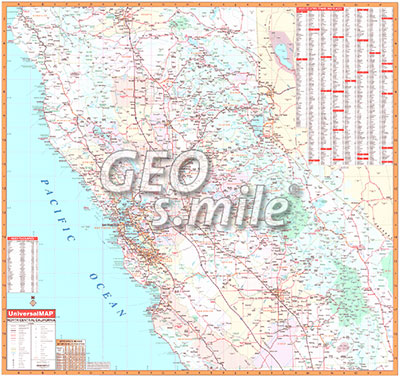
The first edition North Central California Region Wall Map covers approximately 40 counties, measures 54 by 54 inches, uses up-to-date cartography at a scale of 1 inch to approximately 6.6 miles, is indexed on the face of the map, printed in color, and laminated.
Coverage ranges north to Redding in Shasta County; south to include all of Monterey, Kings, and Tulare Counties; east to the Nevada State line including Reno; and west to the Pacific Ocean.
Unsere unschlagbare Preis-Politik:
Beste Qualität zum günstigsten Preis!
Bestellformular Download
Was ist eine Echtholzbestäbung?
Was ist ein Springroller?
Verfügbare Versionen:
California North Central Wall Map - laminated, with rods
(Artikel-Nr.: 100002233)
(Artikel-Nr.: 100002233)
USD 219,00
